Features AgroExecute
Rural Management integrated with geolocation via satellite, allowing traceability.AGROXECUTEIt helps rural producers from planning the field to delivering the product to the customer.
Allowing the agricultural business to comply with the countrys legislation and at the same time bringing the customer closer to those who produce and use AgroExecute, because with traceability it conveys transparency, certification and food safety.Being an excellent opportunity for the customer to identify the product among the others, consequently allowing the final consumer to be faithful in choosing the product, since he can identify a "bridge" to the rural property, through traceability knowing the food and how its production processes occur.
Thus, the use of the AgroExecute application helps to have greater profits by managing: - Geolocation via satellite;-Drawing demarcating the registration of the property from geographic coordinates; - Subdivide the property into smaller areas through plots to demarcate by cultivated crop; -Register information from: row spacing, inputs needed to apply pesticides, planting and harvesting period; - Point out the name of the person responsible for the service, identifying your CNPJ or CPF;– Maintain the history of registered records;- Permission to generate the QRCode with the main traceability descriptions; -Choose the size of the image to print the tracking code; -Possibility of being consistent with the Law (INC 02/2018) that there is traceability; - Able to organize, plan and execute based on secure information.Contact:Number: 88992077786Email :[email protected]
Productivity Tools
Boost your productivity with powerful tools and features.
Learning Tools
Enhance your learning experience with interactive features.
Food & Dining
Discover recipes and order food from your favorite restaurants.
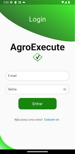
See the AgroExecute in Action


Get the App Today
Available for Android 8.0 and above